Use the official Tokyo Metro and Toei map to understand subway connections, then a journey planner to choose a departure and a station map to find the right exit. These solve different problems. A coloured line tells you where trains run; it does not guarantee the quickest walk, a step-free transfer or coverage by your chosen ticket. 123
For a first visit, learn the few lines serving your hotel and main sightseeing districts. You do not need to memorise the entire network before taking the train.
Start with the correct kind of map
Tokyo Metro publishes an English subway map, and Toei provides a combined map showing the two subway systems. JR East separately publishes metropolitan railway and station-numbering maps. Keep both available when your itinerary includes the Yamanote Line or other JR routes. 124
The subway diagram is designed to make connections legible. It is not a street map drawn to reliable walking scale. Two stations shown close together can have a less convenient pedestrian connection than the diagram suggests; the reverse can also be true.
Use the network map to identify possibilities, not to measure distances. Once you have selected a route, switch to the station's local-area information for the final approach to your destination.
Saving the official map offline is useful, but a saved image cannot report a disruption. Keep a way to access the operator's current service information when something does not match the expected route.
Read the line letter as well as the colour
Subway station numbers combine a line letter with a station number inside the line's colour. Tokyo Metro explains that this helps identify the correct line, count stops and confirm direction. 1
For example, a station served by several lines can have several codes. The code belongs to the station on that particular line, not to every railway platform in the surrounding area.
This matters when a journey planner tells you to transfer. Follow the full line name or letter instead of searching for a vaguely similar colour. Tokyo's railway maps contain more services than the subway alone, and colour is not a sufficient identifier across the whole network.
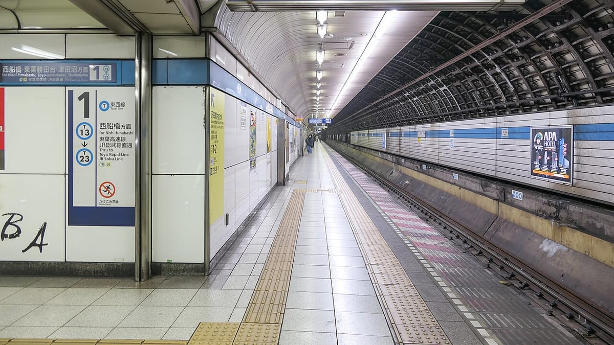
At a platform, check the next station or the destination direction against your route. A clear sequence of two or three station names is often easier to follow than remembering the geographic compass direction of a curved line.
Three useful lines for sightseeing
The Ginza Line links Shibuya, Omote-sando, Ginza, Nihombashi, Ueno and Asakusa. That makes it a useful framework for a trip connecting western shopping districts with the older eastern side of the city. 5
The Marunouchi Line links places including Shinjuku, Tokyo, Otemachi and Ikebukuro. Use it when these are your actual destinations rather than automatically circling the city on JR because the Yamanote Line is familiar.
The Hibiya Line connects Ueno and Akihabara with Ginza, Tsukiji, Roppongi and other stops. Its usefulness is different from the Ginza Line even where the two serve a district in common. 5
These are not three mandatory sightseeing routes. They are starting points for recognising when a direct train already connects two places on your plan.
Before adding a transfer, check whether another station near your destination lies on your current line. A modest walk can sometimes make the journey simpler, but use a real street route to judge it.
Transfers are not all equivalent
A map's interchange symbol tells you that a connection exists. It does not tell you that the platforms are adjacent or that the route avoids stairs. Tokyo Metro's station-information pages provide the next level of detail. 5
For luggage or a stroller, compare the whole transfer rather than the advertised train time. A route with one additional minute on board can be preferable to an awkward interchange.
Some subway connections require walking outside fare gates, and the combined map marks certain transfers at ground level. The Oedo Line also has a loop-shaped section and an extension rather than behaving like a simple endless circular railway. Follow the train destination and required changes instead of treating it as a substitute Yamanote loop. 2
At unfamiliar interchanges, pause before passing an exit gate. Tokyo Metro distinguishes blue transfer guidance from yellow exit guidance in its passenger instructions. Leaving by the first visible exit can turn a straightforward connection into an unnecessary street-level detour. 3
Station names can hide a final walk
"Shinjuku" is not one entrance serving every destination on every side of the district. Similarly, a hotel or attraction may recommend a particular exit that is more useful than whichever stairway you first encounter.
Record the exit recommended by the destination and confirm it on the station map. If you need a lift, find the accessible exit even when it differs from the shortest pedestrian route.
Treat an estimated station-to-hotel walk as beginning at a specified exit, not automatically at the train door. The extra platform and concourse movement matters most when you are carrying luggage or trying to meet a reservation.
A useful planning habit is to save three pieces of information: the line and direction, the station, and the final exit or accessible route. That is usually more actionable than a screenshot of the entire city.
The map does not decide your fare coverage
JR routes, private railways and airport connections appear on or around subway diagrams to help explain connections. Their appearance does not make them part of a Tokyo Subway Ticket. That product covers Tokyo Metro and Toei, not every line drawn on the page. 6
Through services can continue beyond a subway operator's own section. Check the operator boundary and additional fare rather than assuming that remaining in the same train keeps everything inside your pass.
Bank-card tapping has its own coverage too. Tokyo Metro's current service excludes entry at Nakano and cannot be used for through journeys onto JR East. A route that works with a transport IC card may not work with a bank-card tap. 7
Choose the route first, then make sure your payment method covers it. Reversing that order can lead to unnecessary detours or an uncomfortable conversation at the exit gate.
Turn the diagram into a usable daily plan
Group nearby sights into districts and identify only the journeys between those groups. Compare a direct route with the planner's fastest option, paying attention to walking, transfers and the desired arrival time.
On the day, confirm the departure display rather than boarding solely because the platform colour matches. Follow the actual service and destination shown.
For the return, search from where you expect to finish, not from the first stop of the morning. A late dinner can put you near a different station with a more convenient route home.
Tokyo's map becomes manageable when it is used in layers: network for the broad route, journey planner for the train, station plan for the exit. That approach is more reliable than trying to make one diagram answer every travel question.